
Open BIM Site

Open BIM Site is a free application for defining the initial conditions of a project site. Using this tool, users can establish the geographical location of the models, manage different types of maps, enter topographic surfaces and add site-specific elements such as plots and buildings.
This application is integrated into the Open BIM workflow via the BIMserver.center platform.
Scope of the application
Open BIM Site is an application with an international scope as it allows the site conditions of a construction project anywhere in the world to be specified. However, for projects located in the following locations, it includes a connection to national web services to enter site data more easily, as well as obtaining maps and topographic surfaces.
- Spain
- Sede Electrónica del Catastro. Spanish cadastre web service.
- Instituto Geográfico Nacional. Spanish National Infrastructure.
- Portugal
- Direção-Geral do Território. Divisão de Informação Geográfica. Spanish National Infrastructure.
Main features of Open BIM Site
Some of the main features of Open BIM Site are described in the following subsections.
User interface
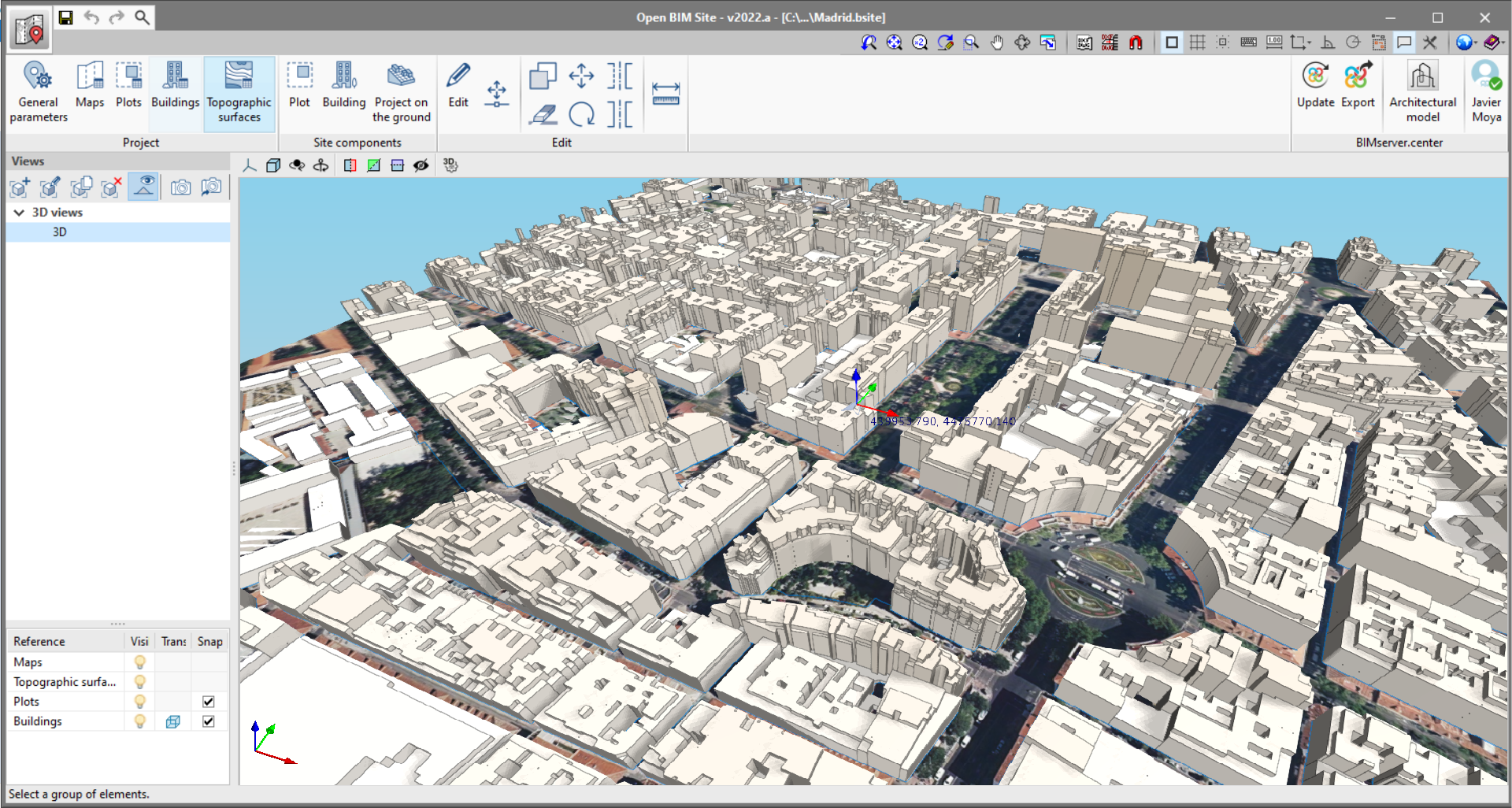
The Open BIM Site user interface has been designed to make it easier for users to define the different aspects describing the project site. For this purpose, it includes several accessible and intuitive tools, as well as a 3D workspace where a realistic model of the environment can be carried out.
In the application’s toolbar, the following groups of options for modelling the project site can be found:
- Project. The program includes the options related to the project location, as well as map management and topographic surfaces.
- Site components. Using these tools, we can enter new elements into the site such as buildings and plots.
- Editing. The application offers a group of tools to modify the elements of the model.
- BIMserver.center. This group contains the options that allow the connection to the BIMserver.center project.
The bar on the left-hand side of the work area in the application contains the views of the model and the tools that allow them to be configured, as well as the viewing options and snaps of the project components.
General settings
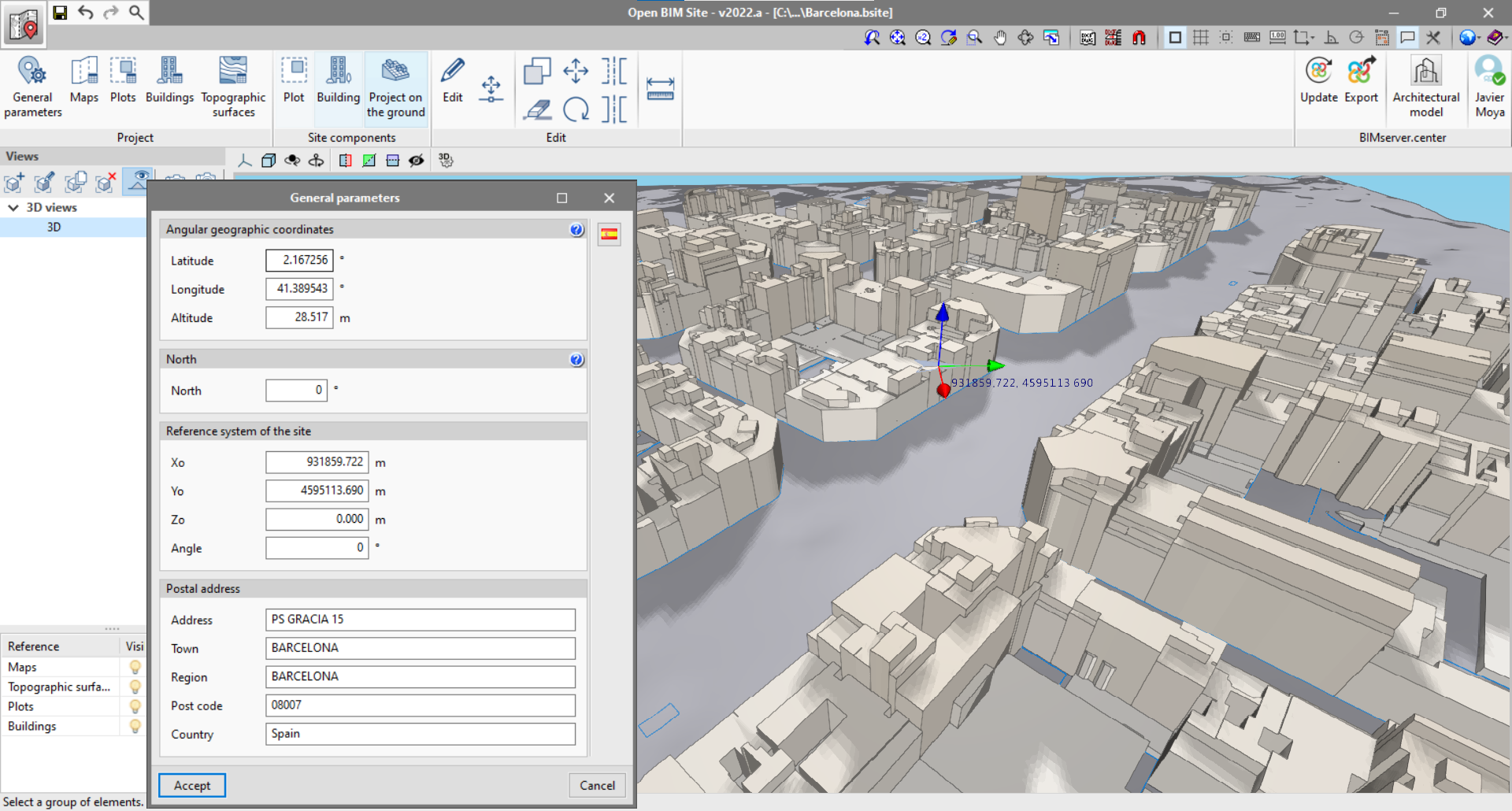
From the "General parameters" panel in the application, users can enter the geographical location and the site data.
- Angular geographic coordinates. In this section, users can enter the latitude, longitude and altitude of the site. The angular geographic coordinates allow the location of the model to be defined in the real world. This information can be used to calculate the natural lighting or perform the energy analysis of the project.
- North. The North direction is defined by the value of the angle relative to the positive Y axis of the project, in the anticlockwise direction. The orientation of the building can be used to calculate the natural lighting or perform the energy analysis of the project.
- Site reference system. This indicates the coordinated position of the project site. Usually, the position of the project site coordinates is shown in UTM coordinates ("Universal Transverse Mercator").
- Postal address. This panel indicates the site address details.
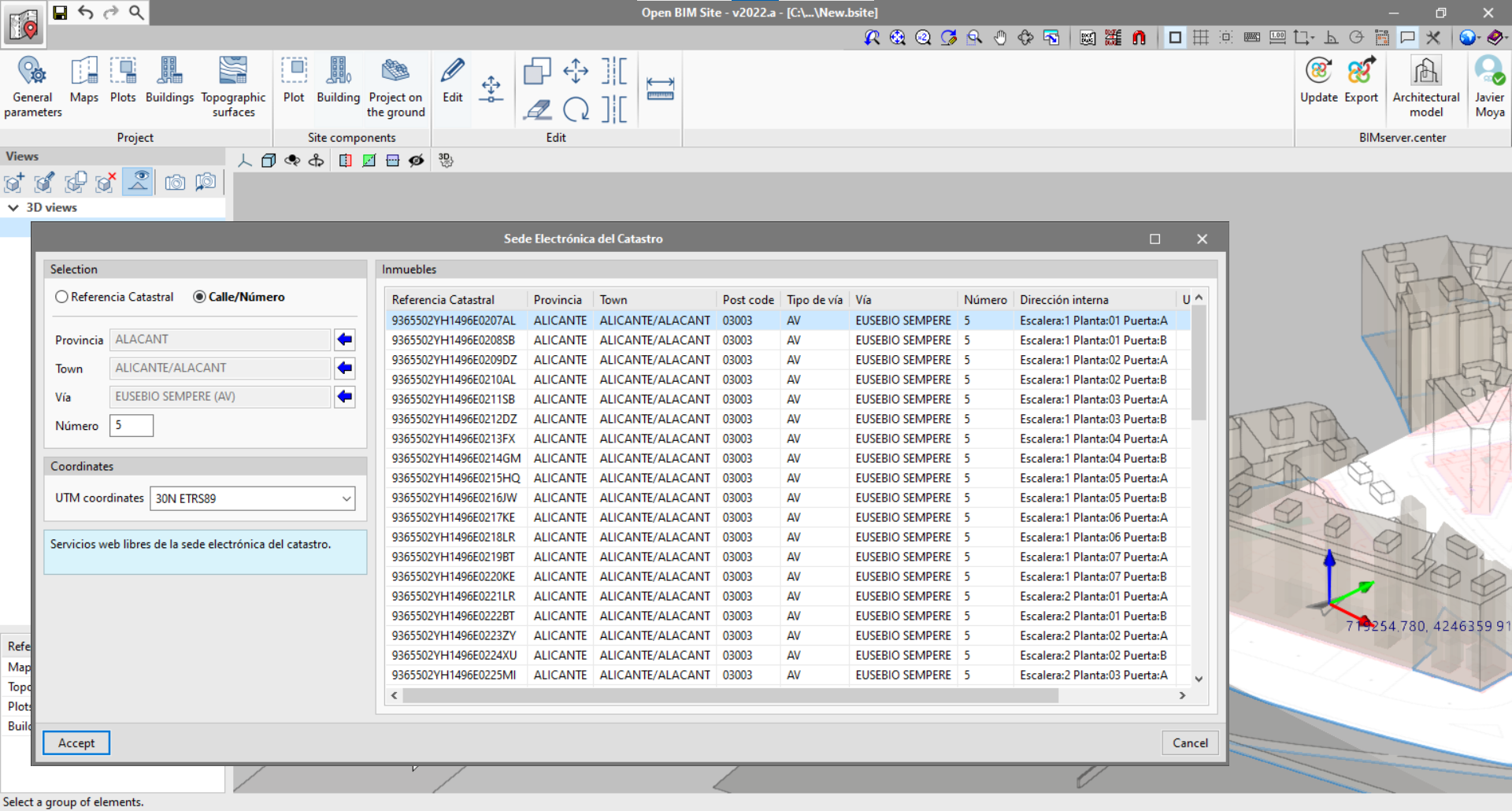
Connection with the Spanish cadastre web service called "Sede Electrónica del Catastro"
Open BIM Site includes a feature for obtaining site data through the connection with the free web services of the Spanish Cadastre (Sede Electrónica del Catastro). This tool allows users to search for properties using the following search types:
- Cadastral reference.
- Street/Number.
Once all the data has been entered, a list with all the properties that match the search criteria will be displayed.
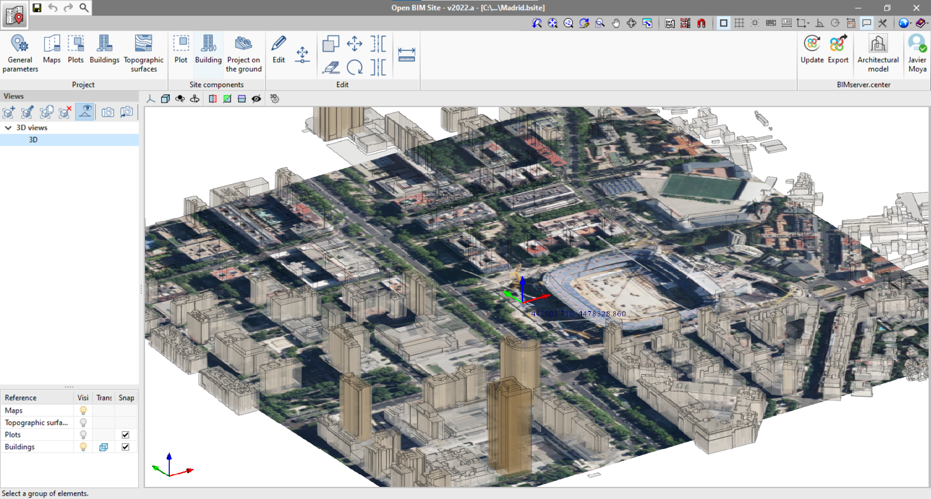
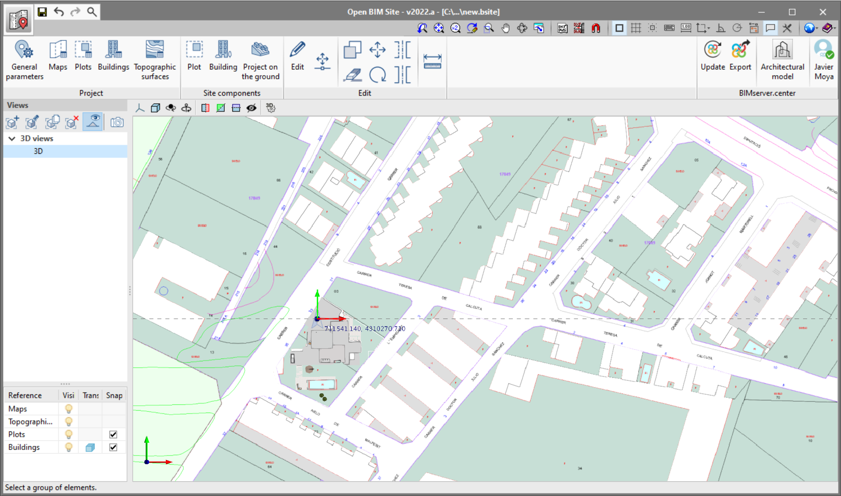
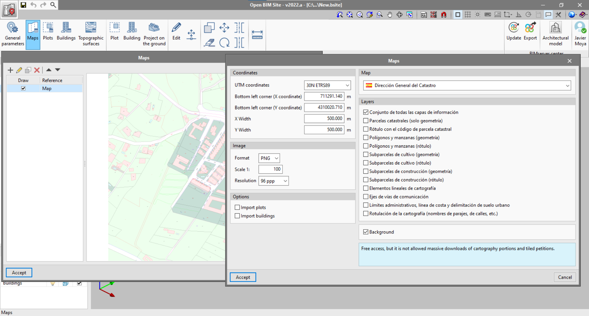
Maps
In addition to the DXF, DWG, JPEG, BMP, PNG, WMF, EMF, PCX and PDF files that can be imported from the application's template manager, users can access WMS web services to obtain spatially referenced maps.
- Coordinates. Indicates the section of the space covered by the WMS service to be imported.
- UTM coordinates.
- Bottom left corner (X coordinate).
- Bottom left corner (Y coordinate).
- X width.
- Y width.
- Image. Setting the properties of the image to be downloaded.
- Format.
- Scale.
- Resolution.
- Options.
- Importing plots. Selecting this option will download the geometry and data of the cadastral plots in GML format via the WFS service of the general management of the Spanish Cadastre.
- Importing buildings. Selecting this option will download the geometry and building data in GML format via the WFS service of the general management of the Spanish Cadastre.
- Maps. Open BIM Site allows different data sources to be selected to obtain the maps.
- Dirección General del Catastro de España. Cadastral cartography of the general management of the Spanish cadastre updated daily from its cartographic bases.
- Dirección General del Catastro de España - INSPIRE. Web map service of the general management of the Spanish cadastre according to the codes from directive INSPIRE.
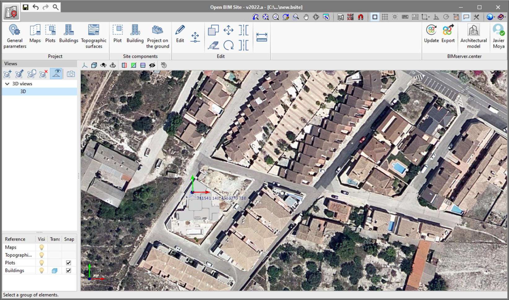
- Orthoimages of Spain (Sentinel-2 and orthophotographs of the PNOA most updated). Digital aerial orthophotographs of the Spanish PNOA (Plan Nacional de Ortofotografía Aérea).
- Layers. Some WMS services allow users to configure the layers of information to be added to the image.
- Ortos 2018 Portugal-Continente. Orthophotos from the Portuguese National Infrastructure "Direção-Geral do Território. Divisão de Informação Geográfica".
The reference and visibility of each one can be controlled from the maps panel via the "Maps" option in the toolbar.
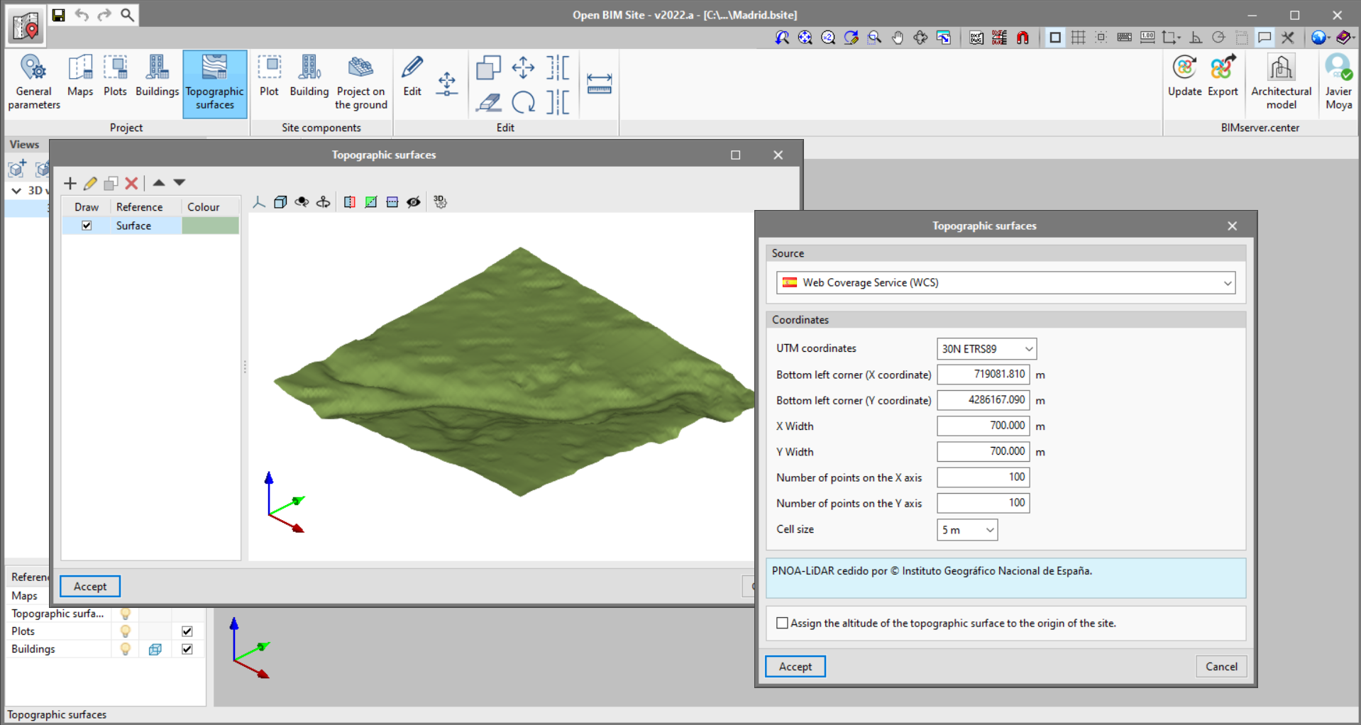
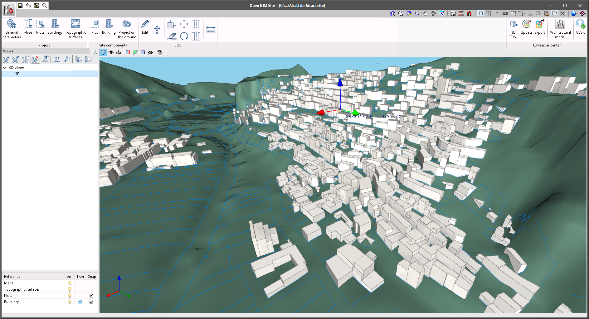
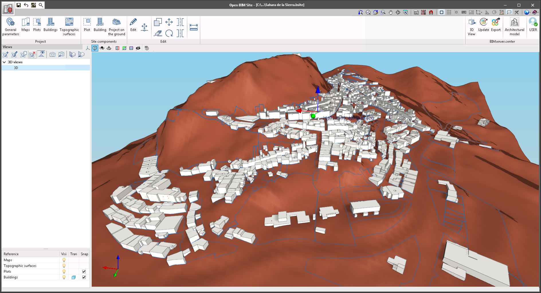
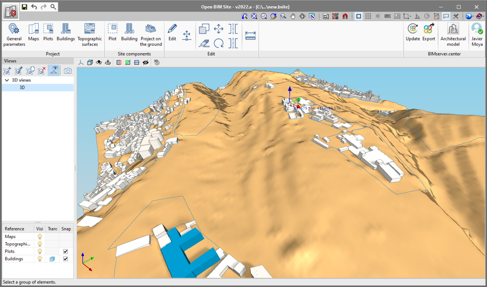
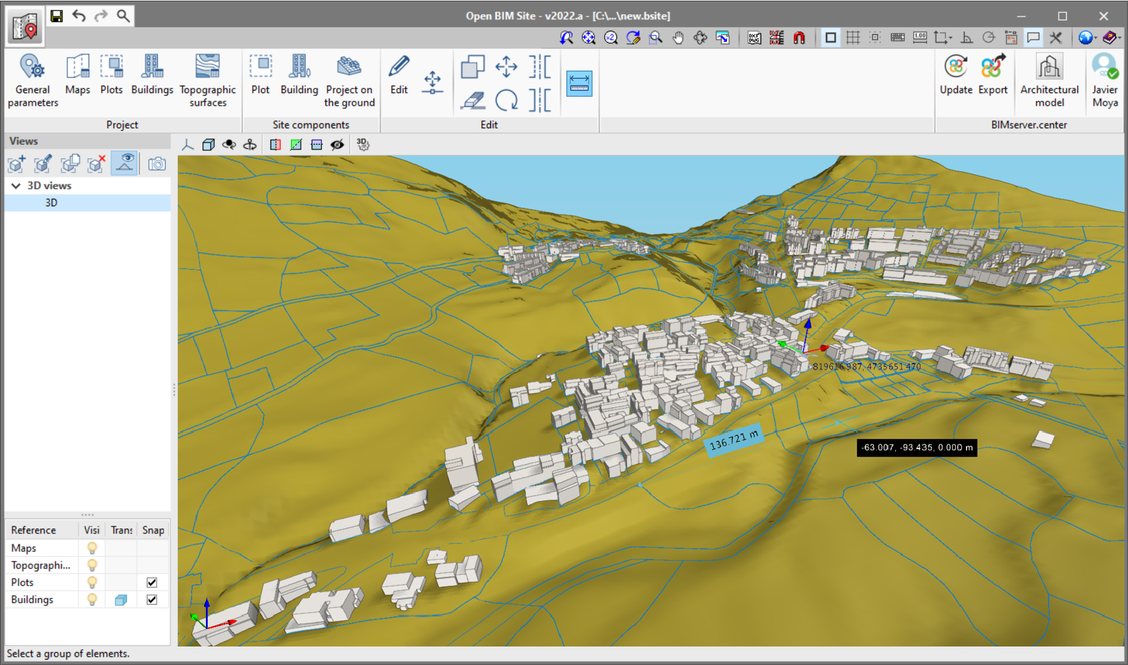
Topographic surfaces
Topographic surfaces allow site topography to be displayed. In Open BIM Site, topographic surfaces can be entered into the model using the following sources:
- Web coverage service (WCS). Through the web service of the Spanish organisation "Instituto Geográfico Nacional", digital elevation models are obtained from airborne LiDAR sensors in the PNOA-LiDAR project within the Spanish public cartography system called "Sistema Cartográfico Nacional". To download this information, the following data is required which users can enter in the application:
- UTM coordinates.
- Bottom left corner (X coordinate).
- Bottom left corner (Y coordinate).
- X width.
- Y width.
- Number of points in the X axis.
- Number of points in the X axis.
- Cell size.
- Points file. A topographic surface can be defined using a point file from a civil engineering application, for example, Open BIM Site can read point files in Esri ASCII format (ARC/INFO) and comma-delimited files (CSV or TXT).
From the topographical surfaces panel, available via the "Topographical surfaces" option in the toolbar, users can control the reference and visibility of each one.
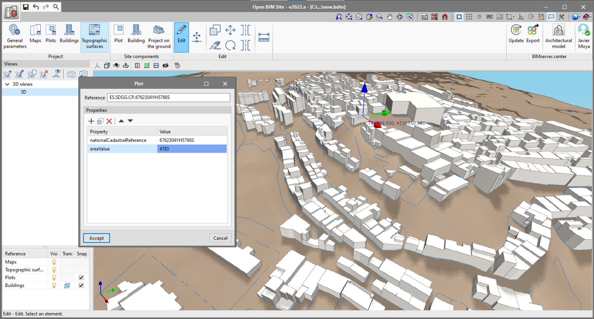
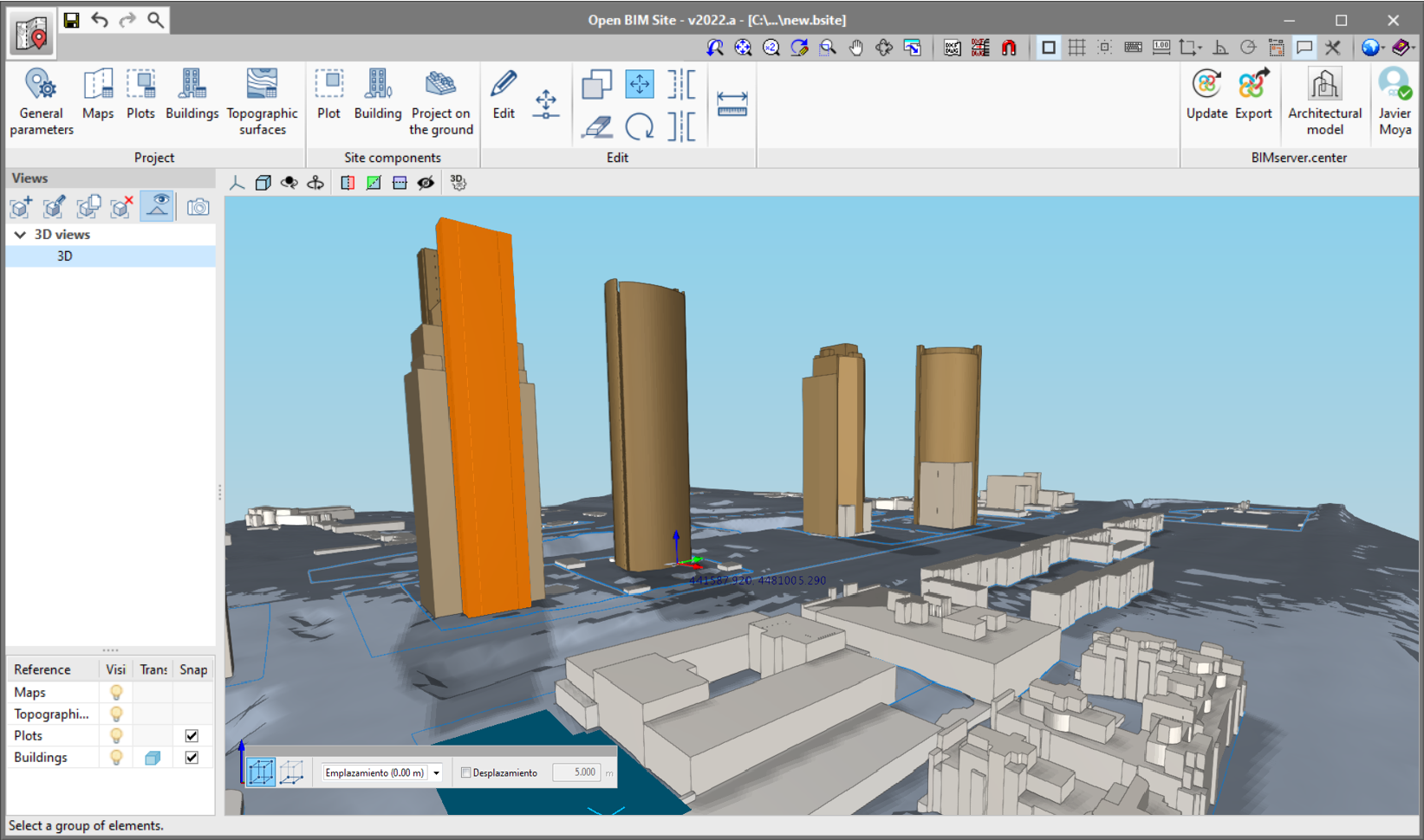
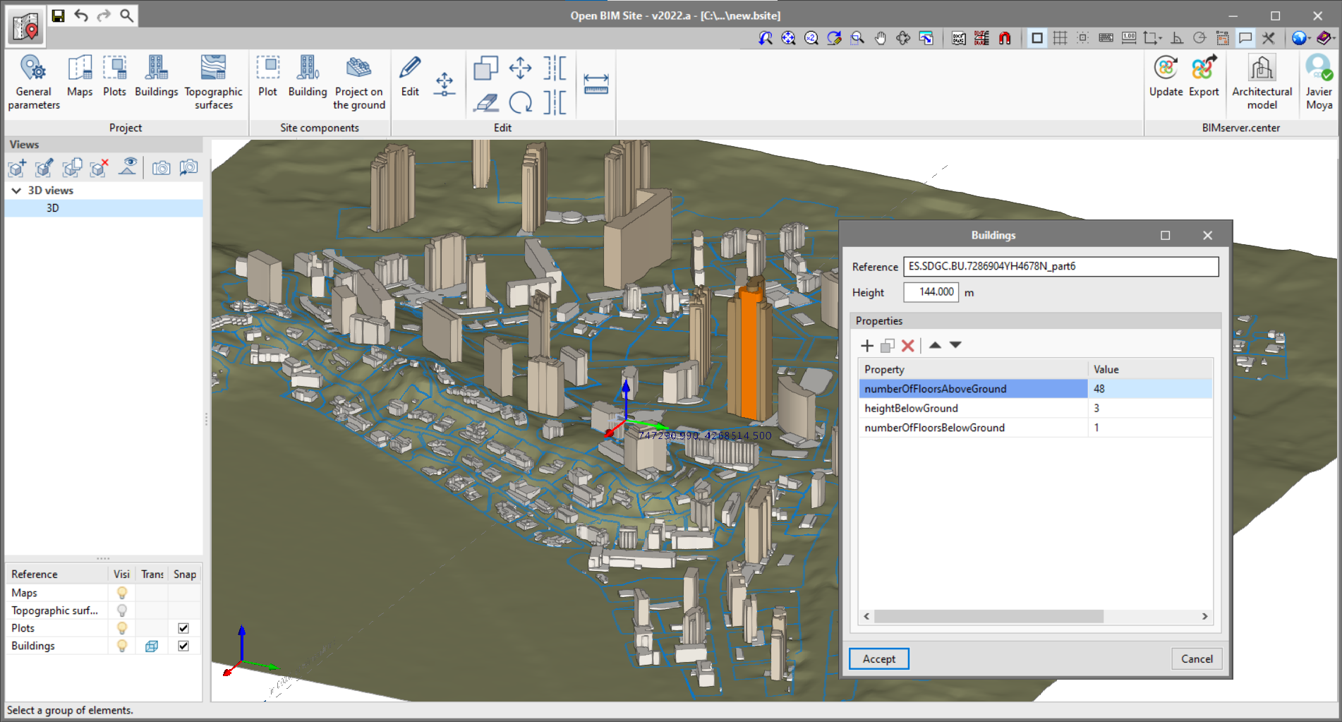
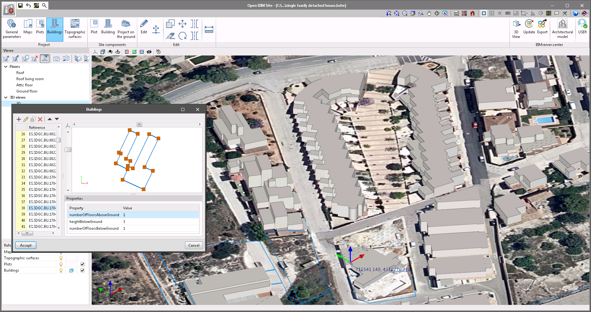
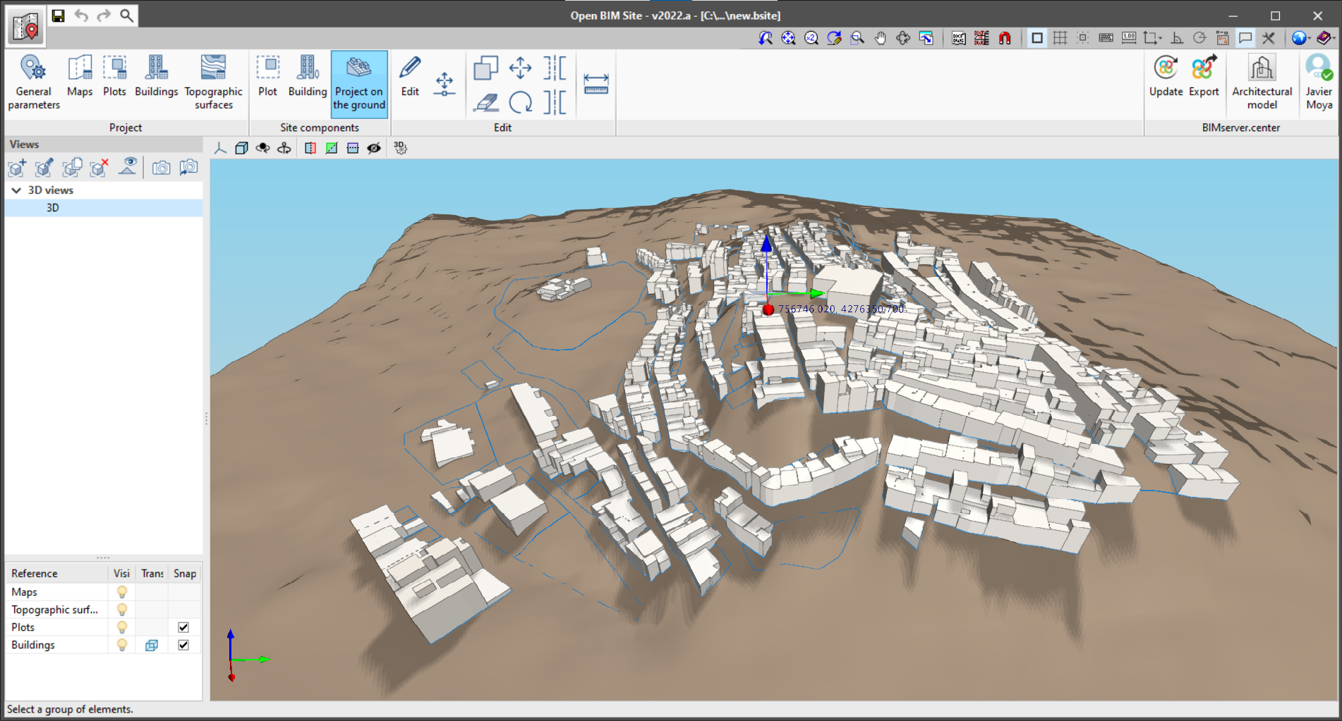
Plots and buildings
Plots are the smallest identified ground boundaries according to the relevant land registry. In Open BIM Site, plots can be defined by entering 3D outlines. A plot may contain buildings that are defined not only by an outline but also by height.
Both buildings and plots may have associated properties for further information.
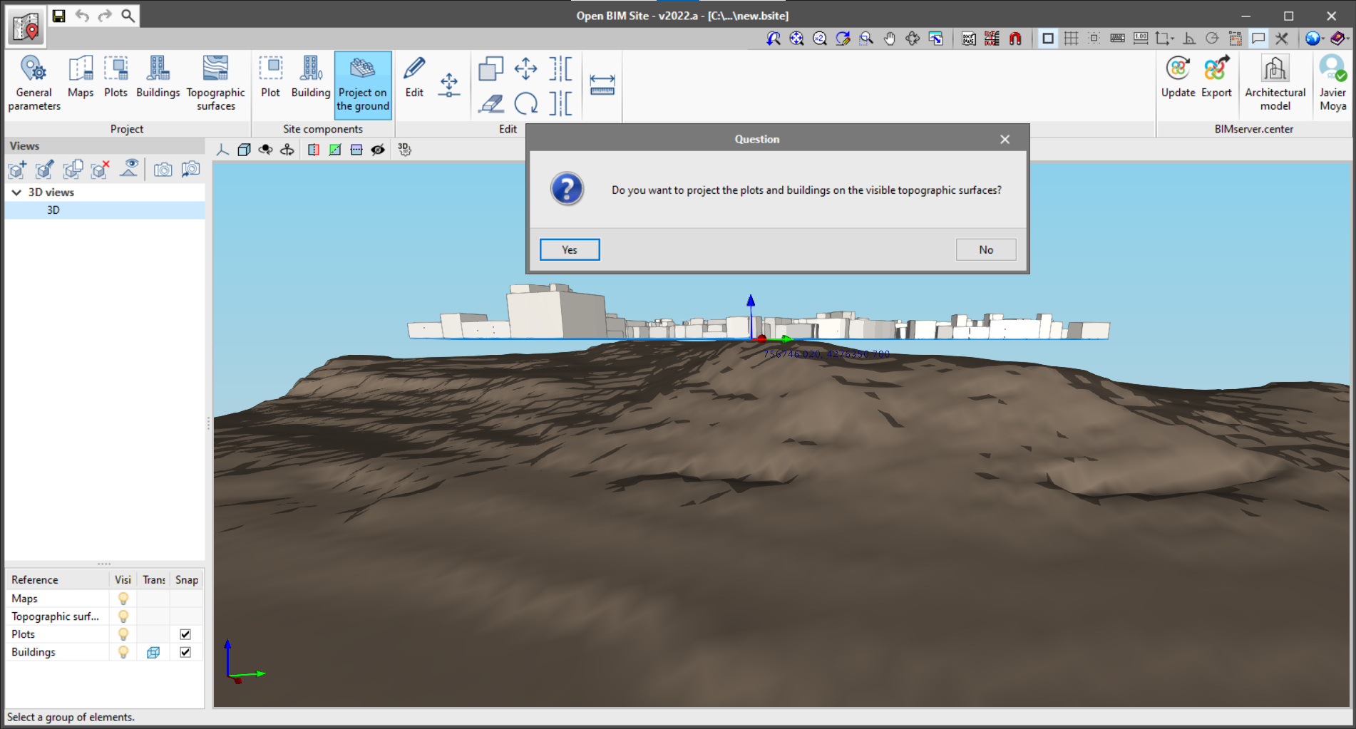
If topographical surfaces have been entered, the outlines of plots and buildings can be projected via the "Project on the ground" option in the application’s toolbar.
Open BIM workflow integration
Open BIM Site is an application integrated into the Open BIM workflow. This integration is carried out through the exchange of information files via the BIMserver.center platform. The program currently performs the following information exchange with the linked BIM project:
- Reading the 3D visualisation files corresponding to the models generated by the different applications involved in the project.
- Exporting the following elements of the Open BIM Site model:
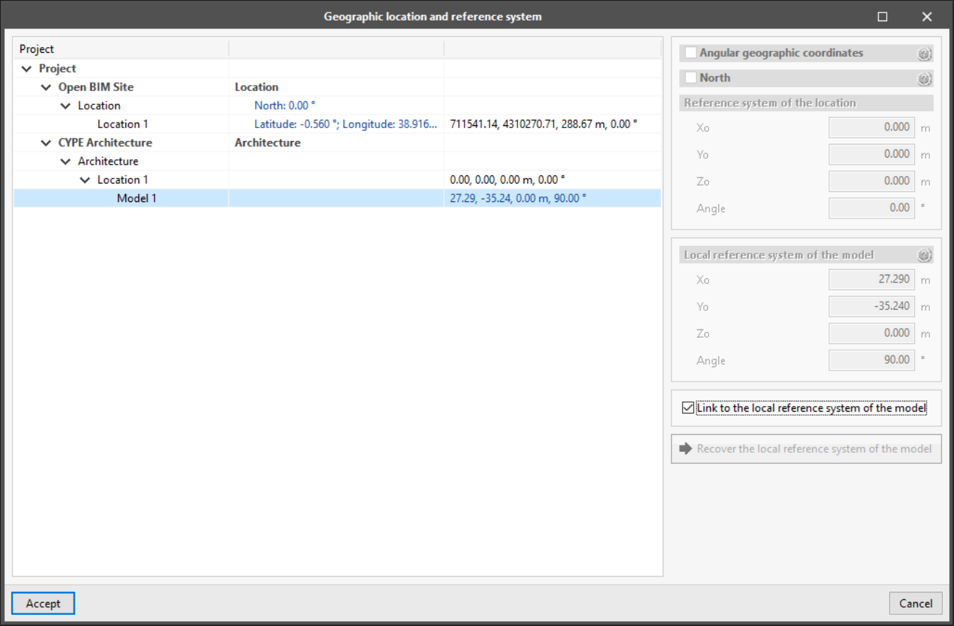
- Site location. The position of the site origin can be read by the other Open BIM applications via the project reference system management tool.
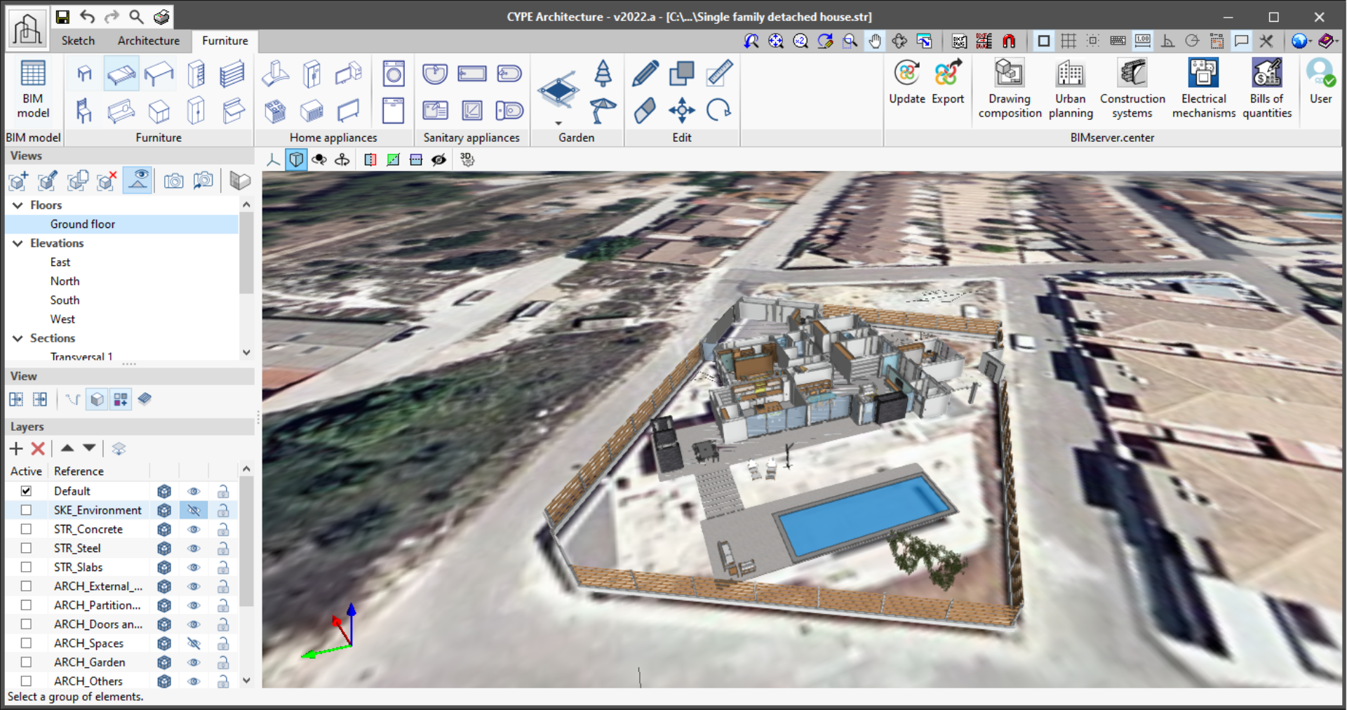
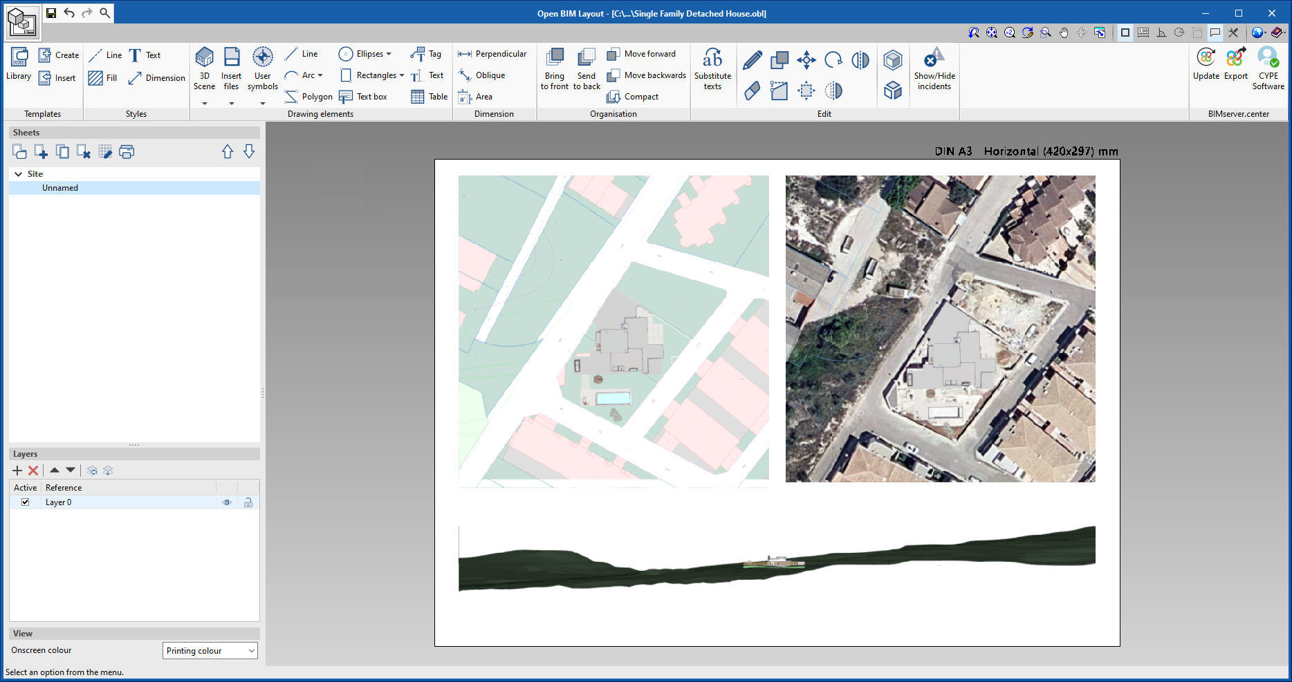
- Maps. Each one of the maps entered into the model is exported in a 3D view file in glTF format. This way they can be displayed independently in the web viewer of the BIMserver.center platform as well as in the other Open BIM applications. This information is especially important when it is combined with an architectural model, in CYPE Architecture or with the generation of project drawings in Open BIM Layout. In the case of CYPE Architecture, the introduction of a building model considering its real position has been simplified. Furthermore, when reading maps in Open BIM Layout, the generation of site and location drawings has been made considerably easier.
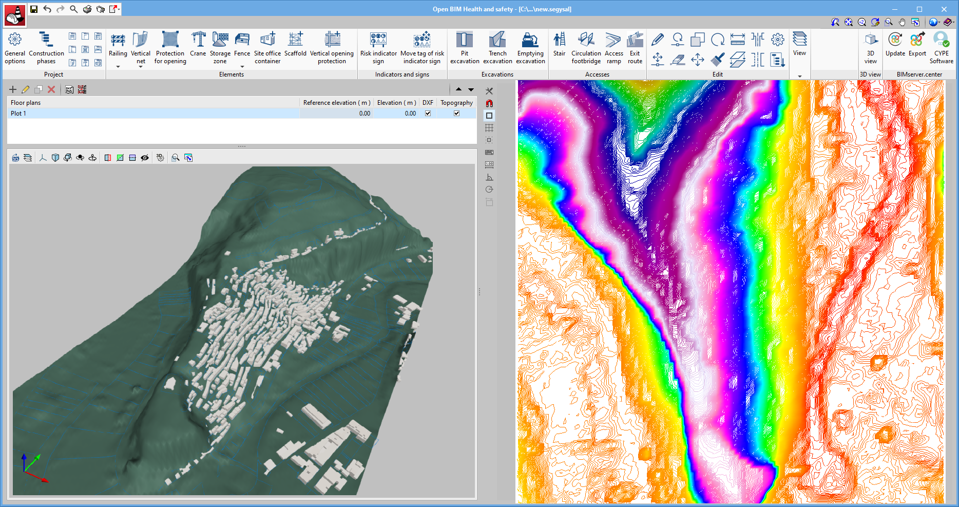
- Topographic surfaces. They are exported both in 3D visualisation files and in glTF format as well as in standardised IFC information exchange files. These elements can be read by urban infrastructure applications Open BIM Sewerage, Open BIM Gas Supply and Open BIM Electrification and the health and safety application Open BIM Health and safety.
- Plots and buildings. Just as with topographical surfaces, plots and buildings are exported in glTF and IFC files.
- Site location. The position of the site origin can be read by the other Open BIM applications via the project reference system management tool.
- Synchronisation with the BIM model. Whenever there is a modification in the BIM model, the program can incorporate the changes to the Open BIM Site project so that users can work simultaneously with other specialists from different disciplines.
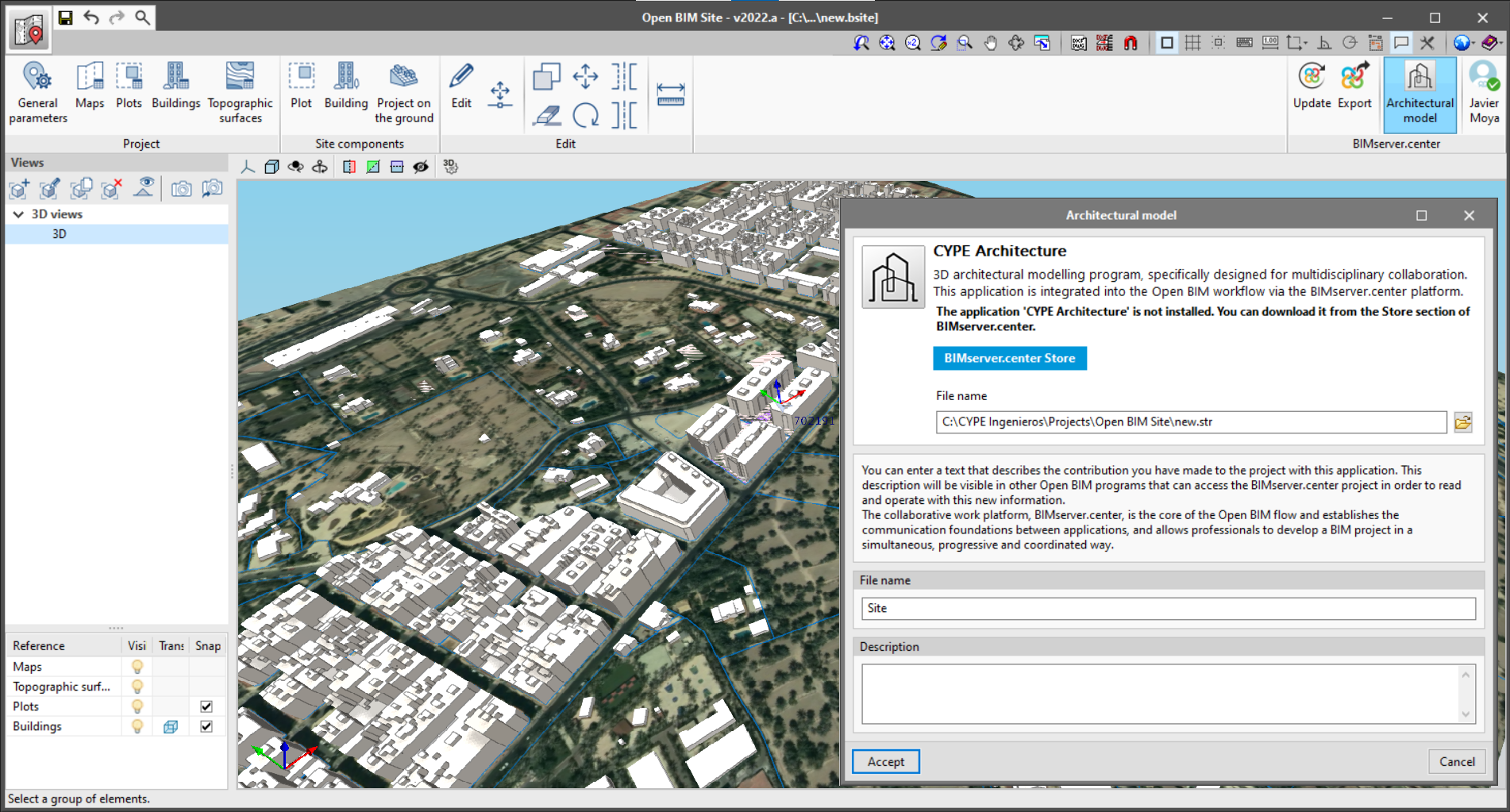
In the BIMserver.center group in the toolbar, as well as the options for "Update" and "Export" the model to the platform, a direct connection is included with the architectural modelling application CYPE Architecture.
More information about the Open BIM workflow proposed by CYPE is available on the Open BIM Technology page in CYPE programs.
More information
Download, resources and available languages, license requirements...
Tel. USA (+1) 202 569 8902 // UK (+44) 20 3608 1448 // Spain (+34) 965 922 550 - Fax (+34) 965 124 950